

Whether you are a hiking novice or a seasoned trekker, we’ve got you covered! Here are 10 of our favorite hikes for 2021.
Before you go, stay safer by checking both weather and fire conditions. If you are hiking in high alpine country, make sure you check avalanche conditions as well.
And don’t forget to check out our list of 10 essential items you should take with you on your excursion. If you don’t already have them around the house, stop by your local Bartell’s to round out the list.
Once you have checked conditions and packed your essentials, you’re ready to hit the Bartrails!
Trails Under 5 Miles:

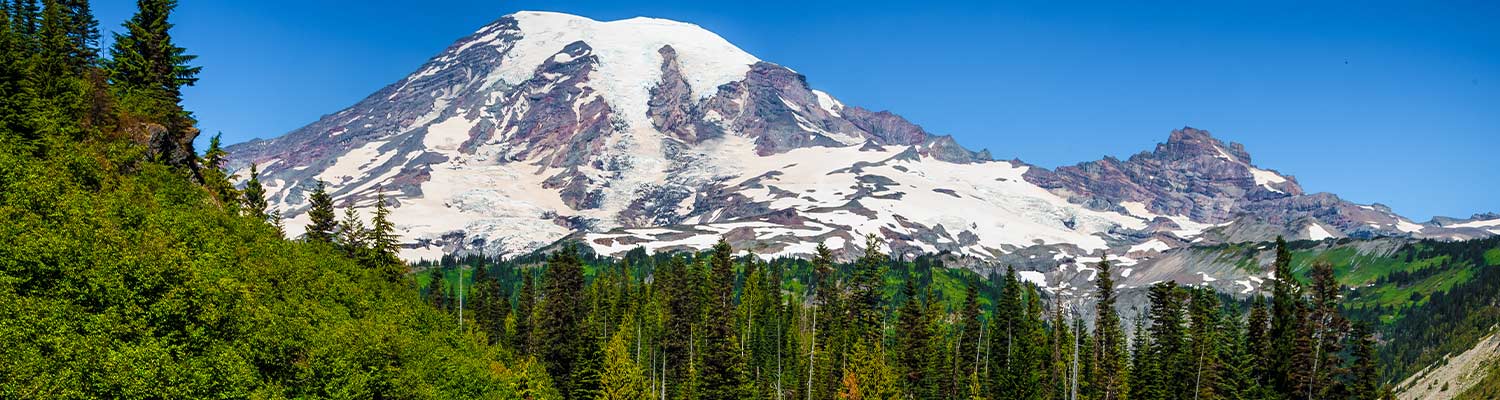
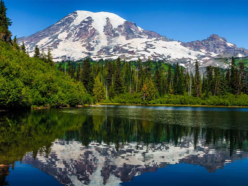
Bench and Snow Lakes
Distance: 2.5 mi
Elevation: 610 ft
Take in views of Rainier with this gentle hike to two alpine lakes.
Noble Knob
Distance: 5 mi
Elevation: 950 ft
This trail has it all, from meadows to lakes to snow-capped peaks, with grandiose views of Rainier to top it all off.
https://www.wta.org/go-hiking/hikes/noble-knob
Ape Caves – reservations needed
Distance: 2.8 mi
Elevation: 350 ft
At a constant 42 degrees, you’ll want a sweater for this hike. Take some flashlights and extra batteries to explore these fascinating lava tubes.
https://www.wta.org/go-hiking/hikes/ape-cave
Hikes of 5 to 10 Miles:
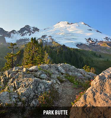
Park Butte
Distance: 7.5 mi
Elevation: 2200 ft
Hike to a historic fire lookout for amazing views of Mount Baker and the surrounding area.
Fremont Lookout
Distance: 5.6 mi
Elevation: 1200 ft
Get stellar views on the Sunrise side of Rainier with this hike to another historic fire lookout.
https://www.wta.org/go-hiking/hikes/mount-fremont-lookout
Ira Spring Trail – Mason Lake
Distance: 6.5 mi
Elevation: 2420 ft
This popular trail in Snoqualmie pass will get your heart pumping as you hike along ridgelines to Mason Lake.
https://www.wta.org/go-hiking/hikes/ira-spring-memorial
Lake Serene
Distance: 8.2 mi
Elevation: 2000 ft
Best to go on weekdays to avoid crowds, Lake Serene has good reason for being so popular. Plus, you get the added bonus of a short side trip to Bridal Veil Falls if you like!
Treks Over 10 Miles
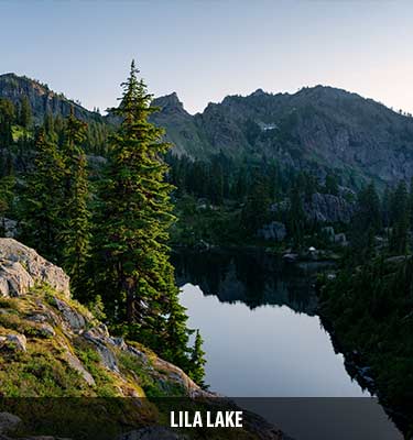
Lila Lake
Distance: 11 mi
Elevation: 2800 ft
Follow the trail to Rachel Lake, then continue above it for another 1.5 miles to reach Lila Lake, with mountain peaks in the backdrop.
Rampart Ridge – Rampart Lakes
Distance: 11 mi
Elevation: 2200 ft
Another trail that branches off from Rachel Lake, the hike to the right branches off to Lila Lake, while the left continues to a series of pothole lakes known as the Rampart Lakes.
https://www.wta.org/go-hiking/hikes/rampart-ridge-1
Horseshoe Basin
Distance: 12 mi
Elevation: 1550 ft
Hike into this vast wilderness and you may have a shot at seeing sheep, deer, and bears. (We highly recommend carrying bear spray!) At the end of the trail, reach your arm out and touch the invisible line that is the Canadian border!
https://www.wta.org/go-hiking/hikes/horseshoe-basin-pasayten