

The days are getting longer and the sun is starting to make its appearance more frequently. It must be spring! Time to break out the hiking boots and go for a walk amongst nature. With an incredible variety of scenery from blooming wildflowers and meadows in the lower elevations to some gorgeous snowy peaks in the upper regions, spring can make for some of the best hiking of the year.
If you do happen to pick some snowier hikes, please check the avalanche conditions before you go. Spring is prime time for avalanches due to the warming ground underneath the snow. Visit www.nwac.us for information.
While we are making great progress on getting Washingtonians vaccinated, it is still very important at to bring a mask with you and wear it while you are passing others as well as maintaining at least a 6-foot distance between yourself and others not in your party.
Earlier in the season:
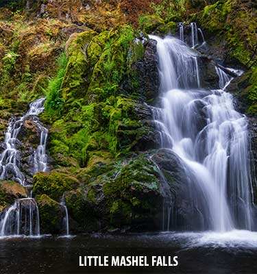
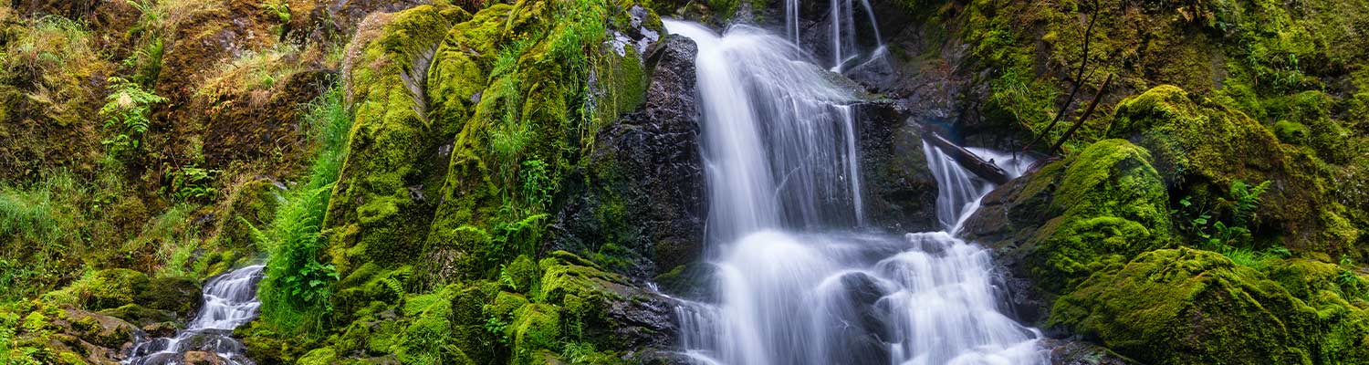
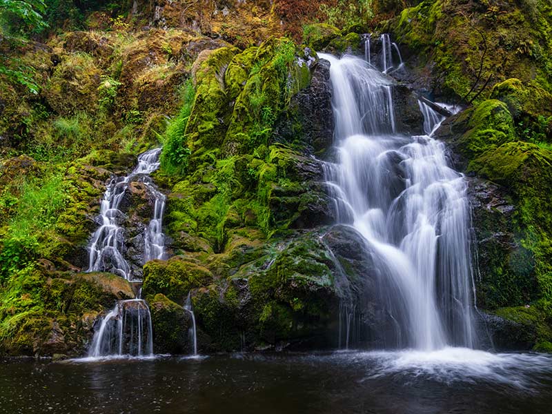
Little Mashel Falls
Distance: 4.5 mi
Elevation: 500ft
A great hike for the whole family, this trail includes 3 waterfalls, the tallest of which is 90ft. In springtime they flow at their highest volume, making them rather impressive.
https://www.wta.org/go-hiking/hikes/little-mashel-falls-bud-blancher-trail
Dash Point State Park
Distance: Up to 19 miles of trails
Elevation: varies
Most people come here for the beach in the summertime, but there are also some really great forested trails to wander that aren’t too far from home.
https://www.wta.org/go-hiking/hikes/dash-point-state-park
Federation Forest State Park
Distance: 5 mi
Elevation: 150ft
Walk through an old-growth forest to the White River near Enumclaw. An easy trip for the whole family.
https://www.wta.org/go-hiking/hikes/federation-forest
Weldon Wagon Road
Distance: 5.4 mi
Elevation: 1290ft
If you’re in search of blooming wildflowers, look no further. This hike near White Salmon begins in a wooded area and ends with views of the valley.
https://www.wta.org/go-hiking/hikes/weldon-wagon-road
Snoquera Falls Loop
Distance: 3.9 mi
Elevation: 975ft
Off of Highway 410 toward Mount Rainier, Snoquera Falls is best done in the spring when water flow is highest. Add on the Moss Lake Trail for a quick side trip.
https://www.wta.org/go-hiking/hikes/snoquera-falls
Later in the season:
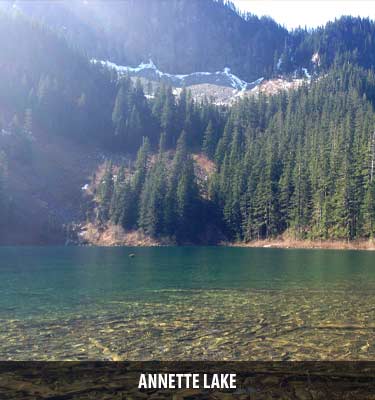
Annette Lake
Distance: 7.5 mi
Elevation: 1800ft
Early on in the trail, cross an impressive waterfall, then walk along the side of the mountain to Annette Lake.
Lena Lake
Distance: 7.2 mi
Elevation: 1300ft
Hike through the forest along streams and waterfalls until you reach the large lake. Pack a picnic lunch and enjoy the view!
https://www.wta.org/go-hiking/hikes/lena-lake
Rachel Lake
Distance: 8 mi
Elevation: 1600ft
Most of the elevation of this trail is gained in the final mile, so be prepared for a huff and puff climb. Makes it all worth it when you arrive at this gorgeous alpine lake.
https://www.wta.org/go-hiking/hikes/rachel-lake
Talapus and Olallie Lakes
Distance: 6.2 mi
Elevation: 1220 ft
These lakes can be snow-covered well into May, but if you time it just right you can hike a mostly snow-free trail and see the last of the winter snow hanging back around the edges of the lakes.
https://www.wta.org/go-hiking/hikes/talapus-and-olallie-lakes
Bonus – Bike Rides!

Bike the Cedar River Trail
Distance: Up to 15.7 mi
With 11 miles of paved trail, this makes for a great day ride along the Cedar River. Great for the whole family.
Bike the Foothills Trail
Distance: Up to 30 mi
For an excellent day trip along the Carbon River, start at the Orting trailhead and ride to Buckley and back for a total of 25 miles.
https://www.traillink.com/trail/foothills-trail/